|
九大景點
當池上斷層出露於自然的地表時,例如:樹林、草叢、田野等,往往不易觀察到地表因斷層而錯動的現象,這應該是地表天然物較鬆軟,把斷層潛移的力道給吸收了。反而是當地表蓋有人工建物時,硬碰硬之下,就容易造成應力集中,形成脆性的破壞。當然,當斷層產生大地震造成數公尺地表錯位時例外。因此,在斷層持續性潛移時,建物破壞是很常見的;本解說站就是個典型的例子。 本站,我們可以觀察到一條排水渠道接近垂直的切過池上斷層。由於斷層的逆衝滑移,造成地表渠道受到擠壓及上盤抬升褶皺,因而產生了好幾道的破裂:橋兩側渠道牆的擠壓破裂(圖一之破裂點、)、渠道尾端突出(圖一之)、牆上道路標線錯位(圖一之)等。科學家持續詳細的分析與測量,顯示每年有約兩公分的水平縮短在此發生。 It is often difficult to trace the Chihshang Fault when the outcrop is covered by trees, grass, and soil. On the other hand, surface human construction can accumulate the shortening due to continue slip on the fault and then break as brittle fractures near the surface fault zone. At this site, we can observe fractures on a concrete water channel, straddling on the Chihshang Fault: fractures on the retaining walls on the both sides of the road bridge (andin Fig. 1), extruding channel bottom at the end of the channel () and offset of lines on the road (). Measurements of shortening on the fractures and local geodetic network at the site indicate a shortening at a rate of about 2 cm/yr revealed by the fractures. 渠道破裂Surface fractures on Channel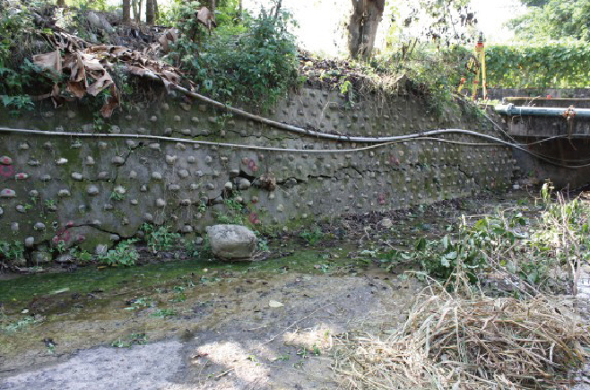
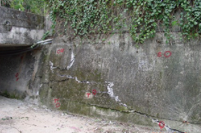
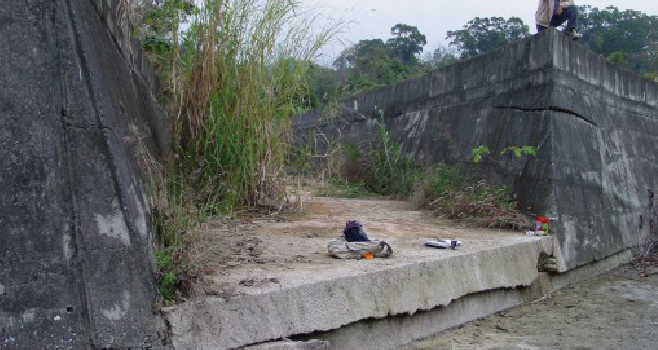
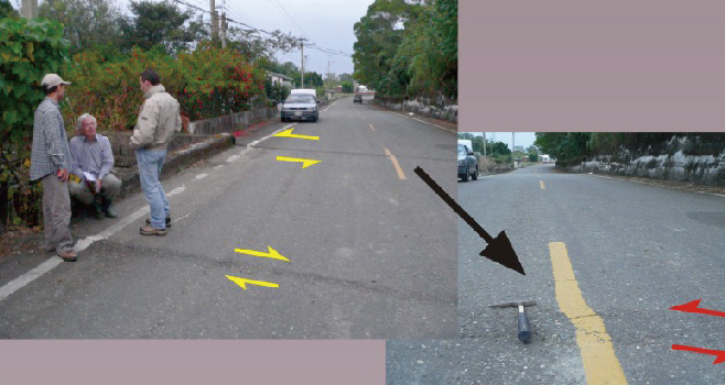

圖一、本解說站之斷層構造剖面及斷層帶人工建物之破壞特色,包括(1)橋上游渠道之破裂(圖中);(2)橋下游渠道之破裂(圖中);(3)渠道尾端突出(圖中);(4):道路標線錯位(圖中)(地質解釋:橋橫貫溝渠,因結構堅固,抵抗被斷層推擠;而橋以外之鬆軟地區則被斷層推擠而向左側移動)。
斷層測量結果Results of Fault motion Measurements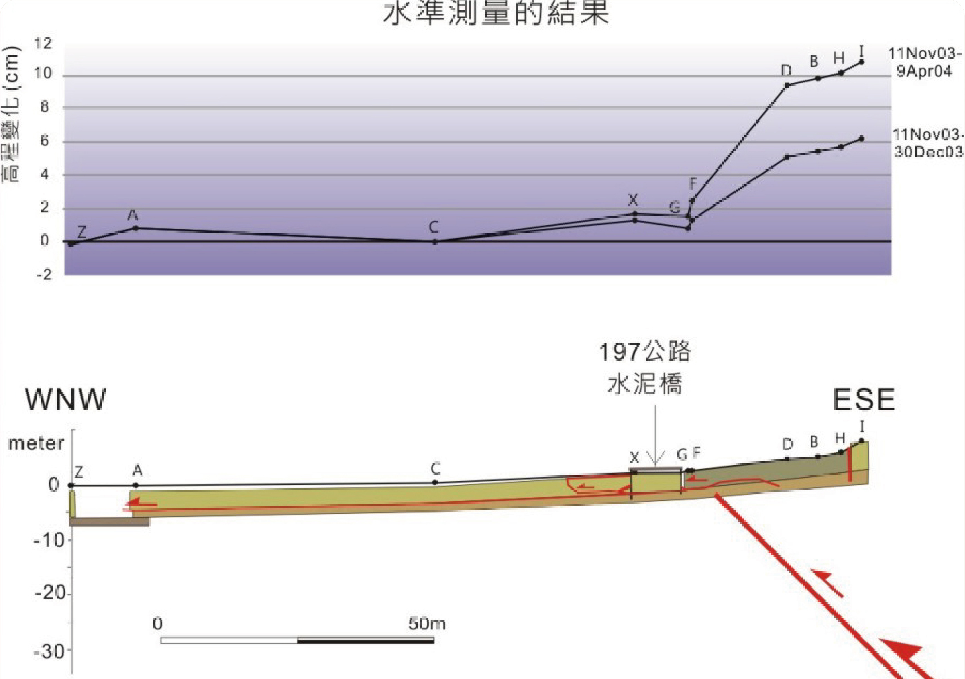
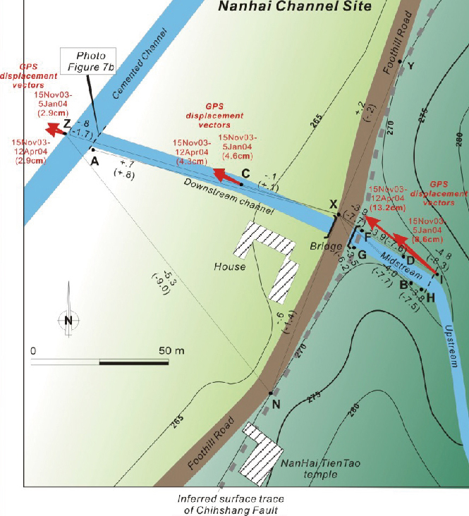
圖二、斷層測量在本解說站之部份成果。左上:成功地震造成之池上斷層地表滑移量超過20公分。左下:水準測量顯示,成功地震同時也造成斷層上盤抬升超過10公分。右上:-橋上游之渠溝破裂造成之縮短量逐年變化曲線,顯示每年有持續性的縮短。
|

