|
九大景點
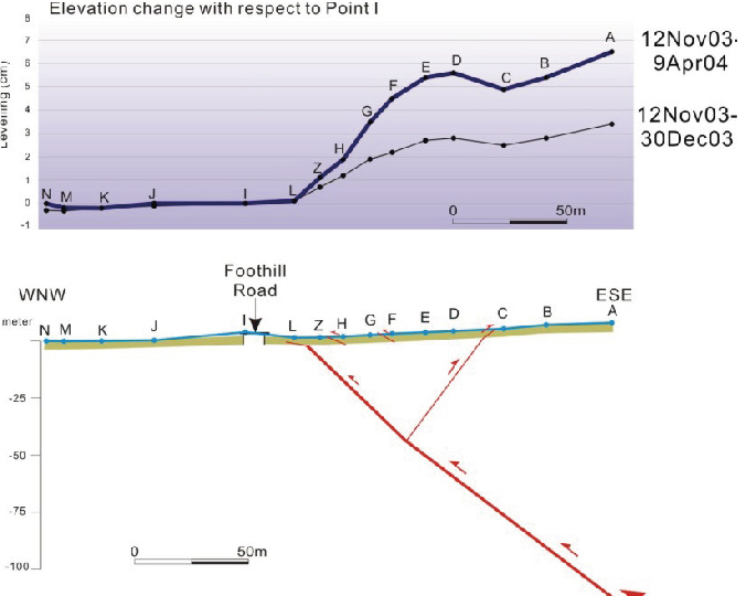
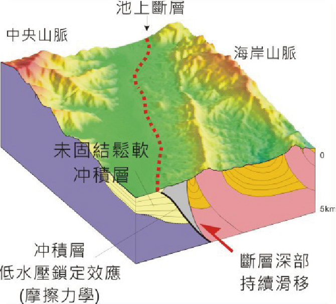
沿著錦園溪護岸兩側,科學家佈設了一個跨越斷層的測量網,裝置了近20個測量地標,每年定期實施GPS、水準、雷射測距測角等測量,以分析斷層帶的變形行為及斷層滑移速率。另外,也特別在地表破裂帶上,佈設了3座潛變儀及7處釘網,監測分析斷層的地表破裂活動。 測量結果發現,主斷層地表位置在錦園橋景觀台東方,斷層上盤呈現一個緩背斜的褶皺變形,寬約40至50公尺。斷層的滑移以每年2-3公分的速率進行,並且有明顯乾季鎖住不動的季節性潛移現象。同時也發現在2003年成功地震前,曾有4-5年潛移速率突然減慢的可疑跡象。 Scientists installed a local geodetic network of about 250 m wide along the two sides of the Chinyuan River channel to analyze the surface deformation across the Chihshang fault. The measurements include GPS, leveling and trilateration. Further, three creep meters and seven nail-networks on the retaining wall at each of the 4-5 surface ruptures. The combined results reveal that the main fault strand is located near the downstream creep meters toward the bridge. The hanging wall of the fault shows an anticline fold with a pop up of about 40-50 m wide. The fault is creeping at a rate of about 2-3 cm per year with an obvious dry-season-locked seasonal variation. We can also observe a curious sudden decrease of creeping rate beginning about 4-5 years before the 2003 M 6.8 Chengkung earthquake. 大地測量網Geodetic Measurements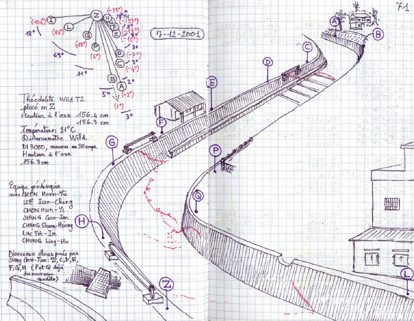
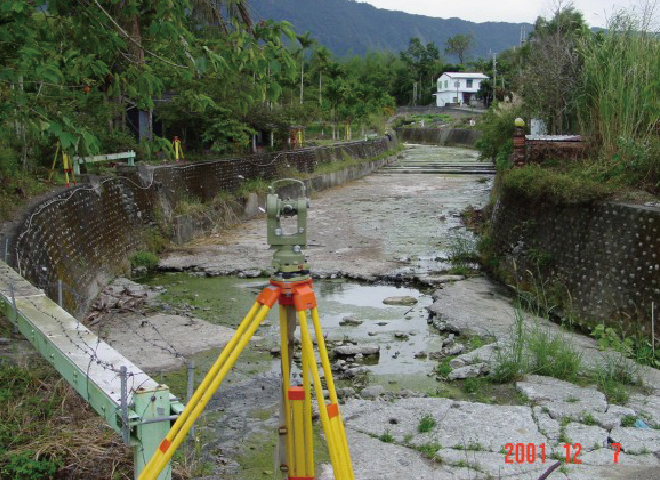
圖一、地質學家在錦園溪兩側佈設了大地測量網,裝置了約20個地標進行每年定期測量,以了解斷層帶的變形行為及斷層滑移模式。
潛變儀測量Creep meters Measurements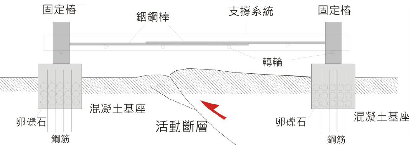
圖二、地表變形精密測量之「潛變儀」剖面示意圖,顯示測量儀跨越池上斷層地表破裂線。
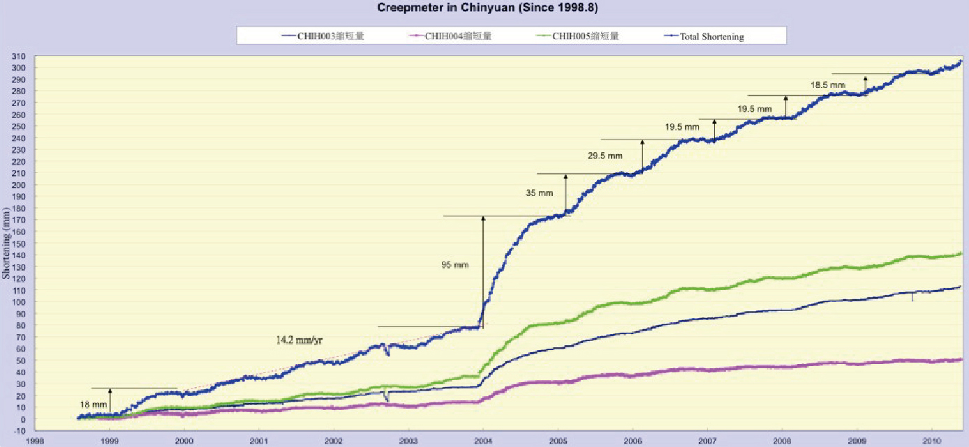
圖三、錦園溪三個潛變儀紀錄了池上斷層的地表破裂縮短量(1998-2010)。
科學小小問:斷層有季節性活動?池上斷層錦園斷層帶的測量,顯示了每年乾季斷層都有鎖定不動的現象,似乎明顯的指示雨水影響了斷層的滑移。但是,究竟雨水影響的範圍有多深呢?科學家應用斷層摩擦力學的理論,模擬雨水滲透至地底下造成斷層帶水壓的變化,發現斷層在乾季因摩擦力增加而不動,雨季則因摩擦力減低而滑移,雨水影響的模擬深度在數百公尺左右。這個乾季斷層鎖定的影響深度,似乎與斷層下盤縱谷沖積層的厚度十分接近,而這個未固結的礫石層,正具有鎖定滑移的特殊力學性質。因此,數百公尺厚的縱谷沖積層,儼然就是池上斷層季節性活動的主要原因。 |

